Get ready for a fun trip from Houston, Harris County, Texas, United States to Wichita Falls, Wichita County, Texas, United States. This journey is great for friends or family who like taking turns driving or traveling together.
How far? Driving distance is 605.92 kilometers (376.50 miles)
How long? About 6 h 46 min by car
Sky's the Limit - Direct Flight Distance is 547.42 km (340.15 miles)
Flight time: 1 h 11 m
You'll have all the details for your journey from the vibrant Houston, Harris County, Texas, United States to the energetic Wichita Falls, Wichita County, Texas, United States, ensuring a smooth adventure ahead. Enjoy your trip! Travel options include Car, Public Transport, Flights, or any other preferred method.
Drive Cost Calculator - Houston to Wichita Falls
Directions from Houston, United States to Wichita Falls, United States
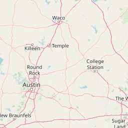
North Freeway, I 45
605.9 km, 6 h 47 min
| Head southeast on McKinney Street | 150 m |
| Turn right onto Milam Street | 100 m |
| Turn right onto Lamar Street | 400 m |
| Turn right onto Bagby Street | 200 m |
| Turn left onto Walker Street | 45 m |
| Take the ramp on the left towards I 45 North: Dallas | 400 m |
| Merge left onto Gulf Freeway (I 45) | 1.5 km |
| Continue onto North Freeway (I 45) | 400 km |
| Take exit 286A towards Waco | 1 km |
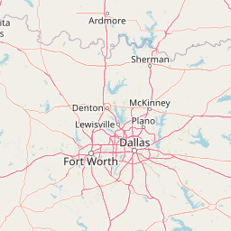
| Continue onto Woodall Rodgers Freeway (Spur 366) | 1.5 km |
| Take the ramp towards I 35E North: Denton | 700 m |
| Merge left onto North Stemmons Freeway (I 35E) | 6 km |
| Keep left towards TX 183: Irving | 1 km |
| Keep right onto John W Carpenter Freeway (TX 183) | 2.5 km |
| Keep right towards TX 114 West: Grapevine | 20 km |
| Keep right towards TX 114 West: Bridgeport | 15 km |
| Keep left onto TX 114 | 25 km |
| Keep left onto TX 114 | 150 km |
| Take the ramp towards Business District | 500 m |
| Continue onto Broad Street | 200 m |
| Turn left onto 13th Street | 500 m |
| Turn left onto Clark Street | 20 m |
| Turn right onto Huff Street | 150 m |
| Turn right | 30 m |
| You have arrived at your destination, on the left | 0 m |
TX 6, I 35W
606.1 km, 6 h 51 min
| Head southeast on McKinney Street | 150 m |
| Turn right onto Milam Street | 100 m |
| Turn right onto Lamar Street | 400 m |
| Turn right onto Bagby Street | 200 m |
| Turn left onto Walker Street | 45 m |
| Take the ramp on the left towards I 45 North: Dallas | 400 m |
| Merge left onto Gulf Freeway (I 45) | 1.5 km |
| Continue onto North Freeway (I 45) | 15 km |
| Take exit 57B towards TX 249 | 250 m |
| Go straight onto North Freeway Frontage Road | 550 m |
| Turn left onto West Mount Houston Road (TX 249) | 4.5 km |
| Continue onto Tomball Parkway (TX 249) | 6 km |
| Continue straight to stay on Tomball Parkway (TX 249) | 15 km |
| Continue onto Tomball Tollway (TBT) | 15 km |
| Continue onto MCTRA 249 Tollway (TX 249 Toll) | 4 km |
| Continue onto Aggie Expressway (TX 249 Toll) | 40 km |
| Continue onto State Highway 105 (TX 105) | 9 km |
| Turn right onto State Highway 6 (TX 105) | 250 m |
| Take the ramp on the left | 250 m |
| Merge left onto TX 6 | 150 km |
| Take the ramp onto TX 6 | 400 m |
| Turn right onto East Loop 340 (Loop 340) | 8 km |
| Take the ramp | 100 m |
| Take the ramp towards I 35 North | 450 m |
| Merge left onto Purple Heart Trail (I 35) | 50 km |
| Keep left towards I 35W: Fort Worth | 80 km |
| Take the ramp on the left towards I 35W Express North: I 35W TEXpress North | 15 km |
| Take the ramp towards US 81 North: Decatur | 1 km |
| Merge left onto US 81 | 2.5 km |
| Continue onto US 81 | 150 km |
| Take the ramp towards Business District | 500 m |
| Continue onto Broad Street | 200 m |
| Turn left onto 13th Street | 500 m |
| Turn left onto Clark Street | 20 m |
| Turn right onto Huff Street | 150 m |
| Turn right | 30 m |
| You have arrived at your destination, on the left | 0 m |


We'd Love to Hear from You!
Your thoughts and insights are important to us. Be the first to share your comments on this topic!